EF2 Tornado of May 7th 2024 in Portage Michigan
The challenge of forecasting the tornadoes along with pictures of damage.
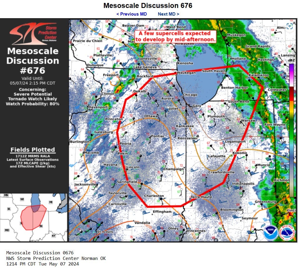
Kalamazoo county was near the NE corner of an area where severe weather was a threat on Tuesday May 7th and Mesoscale Discussion # 676 was issued by the Storm Prediction Center at 1:14 pm EDT detailing the risk after a band of light showers had passed through SW Michigan.
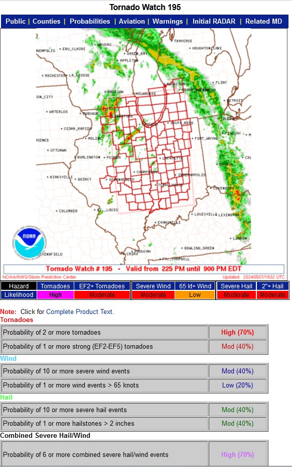
At around 3 pm EDT Tornado Watch #195 was issued along with the probabilities estimated below.
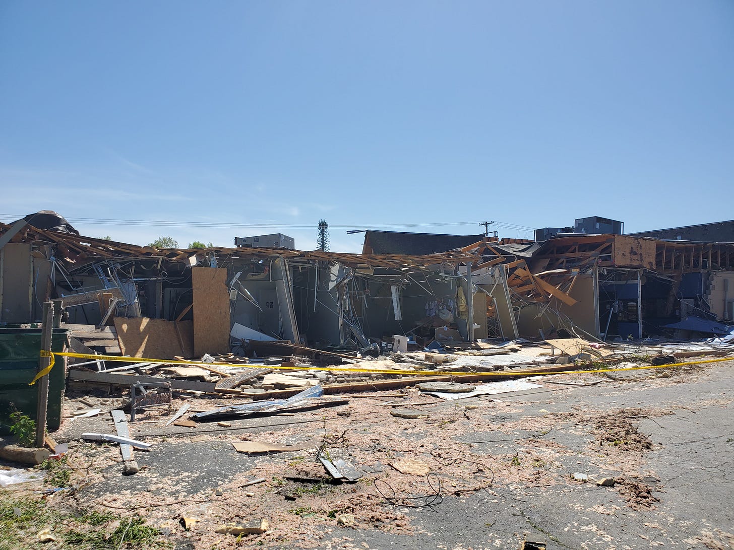
As a teaser of what was about to happen in Portage Michigan, here’s an image of the back of a strip mall on the NE corner of Centre Ave and Oakland Dr.
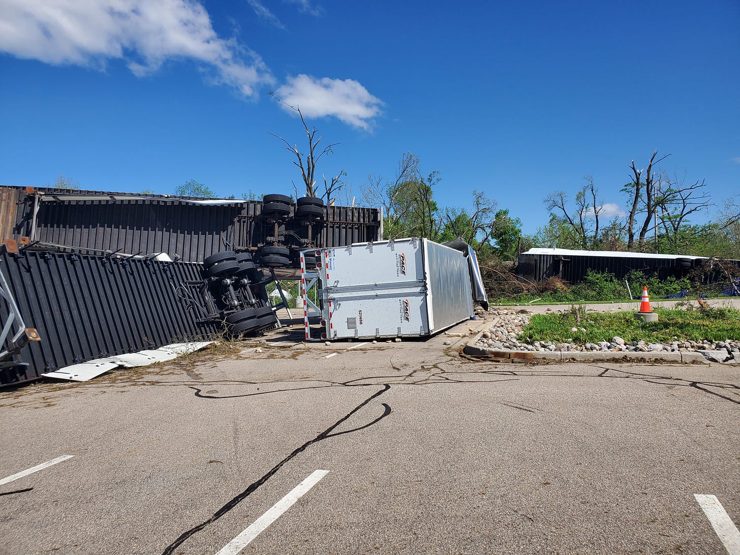
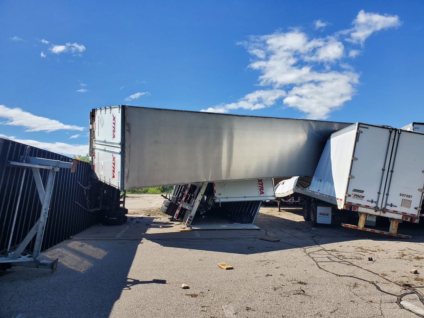
And a view of some of the semi trailers parked NW of the Romence Road / Portage Road intersection behind the Stryker office building that used to be called the Upjohn Quads. Some were tossed around like toys while others remained where they were parked, illustrating the turbulent nature of tornadoes.
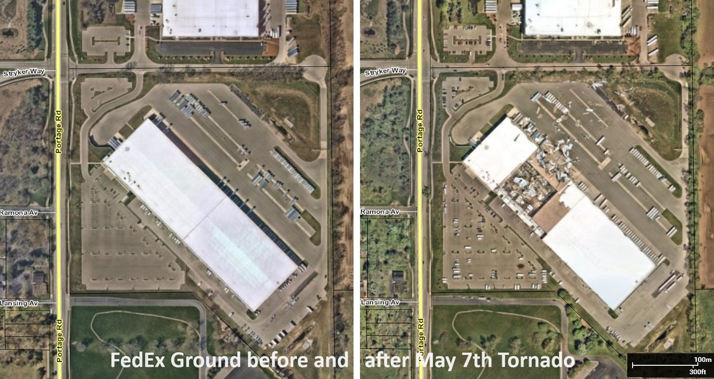
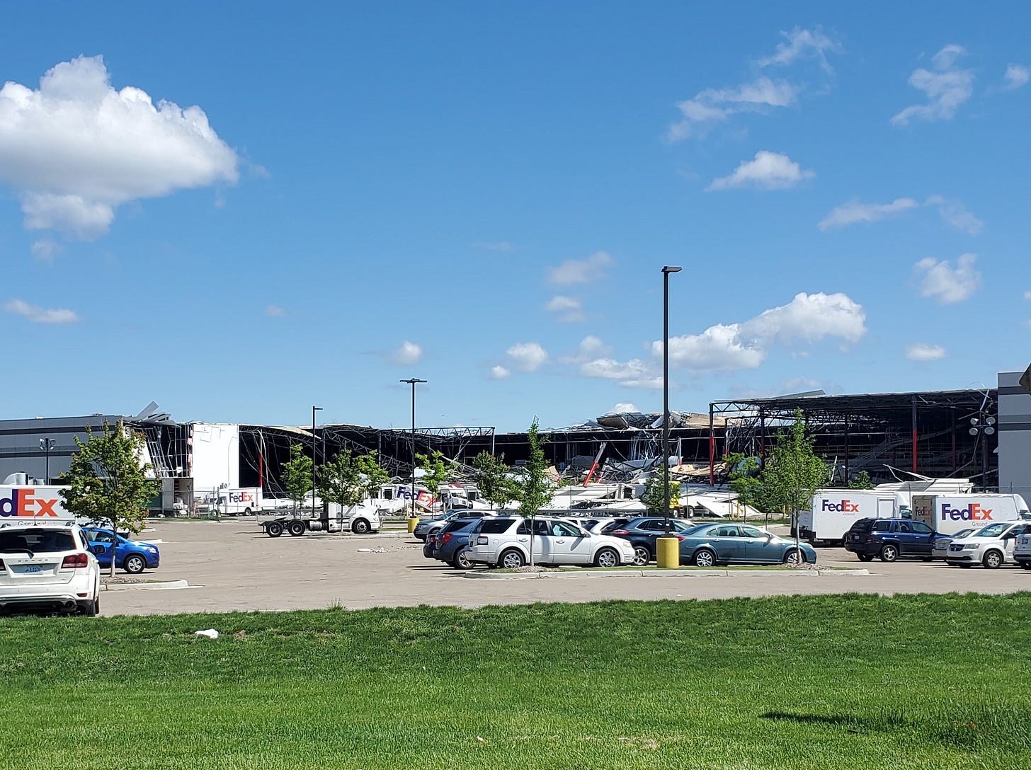
This before and after aerial view from the City of Portage GIS Mapping web site shows the huge FedEx Ground Facility on Portage Road (near the AZO airport) that the tornado sliced through.
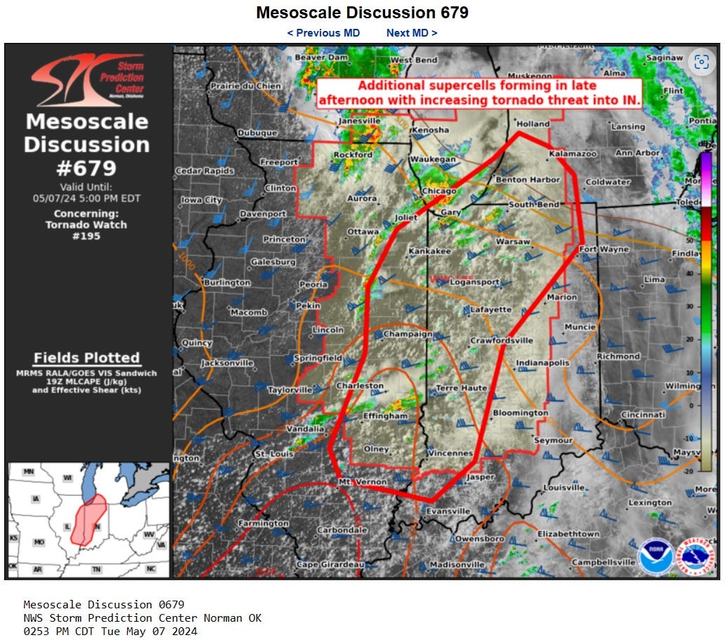
Now back to the development and forecasting of the storms. Mesoscale Discussion #679 provided additional information just before 4 pm EDT as the link details. A key ingredient that was mentioned though perhaps underplayed for southwestern Michigan appears to have been an intense mid/upper-level jet that had been ejecting across northern Illinois and was moving across the Lake into southern Lower Michigan.
Supercell spawns tornado
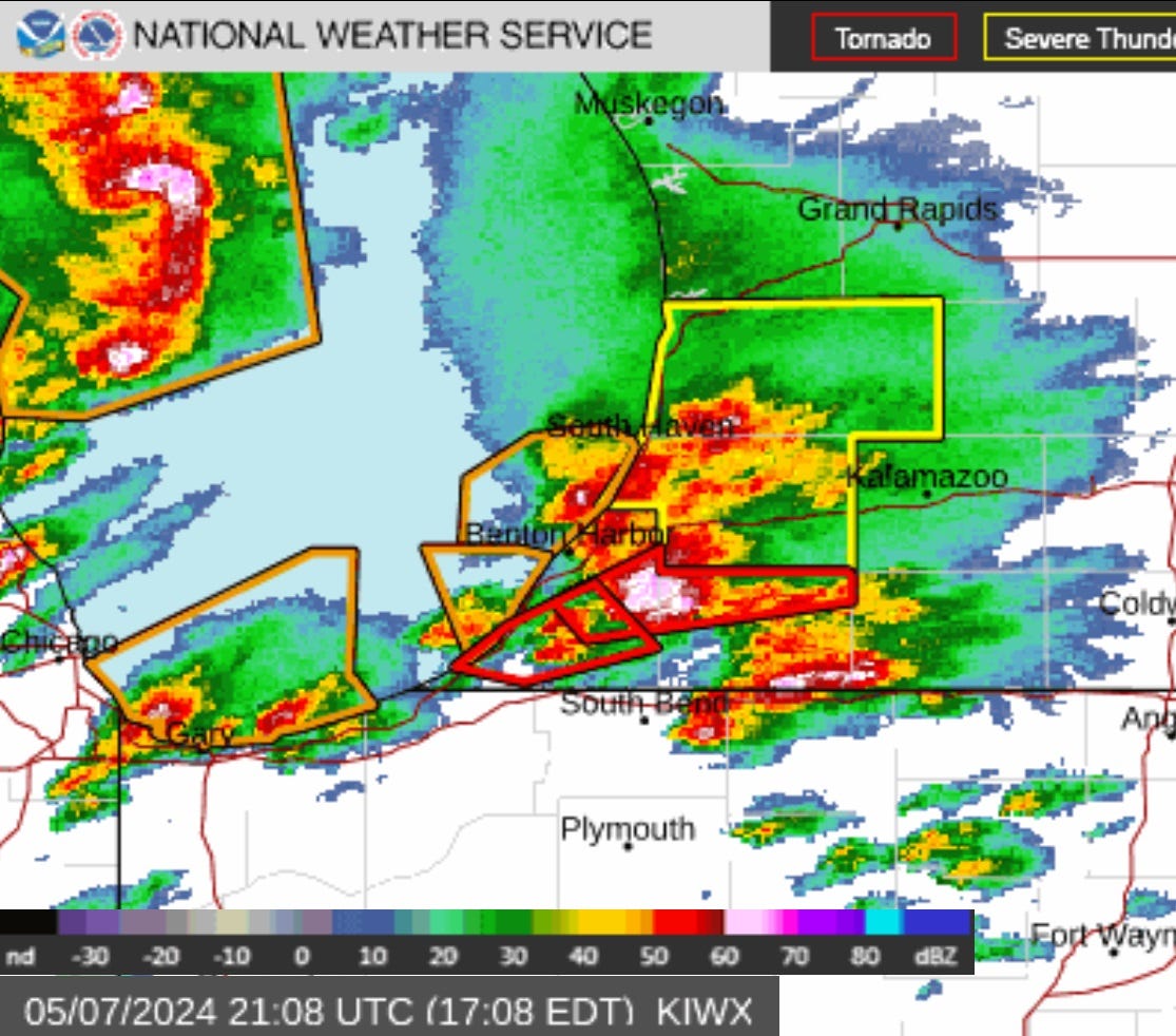
Convection had popped up as shown by the Northern Indiana radar at 5:08 pm EDT after the first tornado warning in Berrien County was followed up by one that extended across northern Cass County (areas outlined in red while yellow denotes severe thunderstorm warnings. Note also the streak of convection just north of the Indiana state line that would soon spawn a separate tornado.
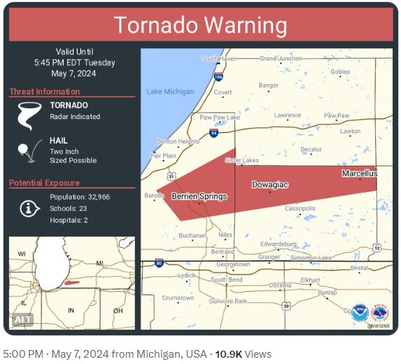
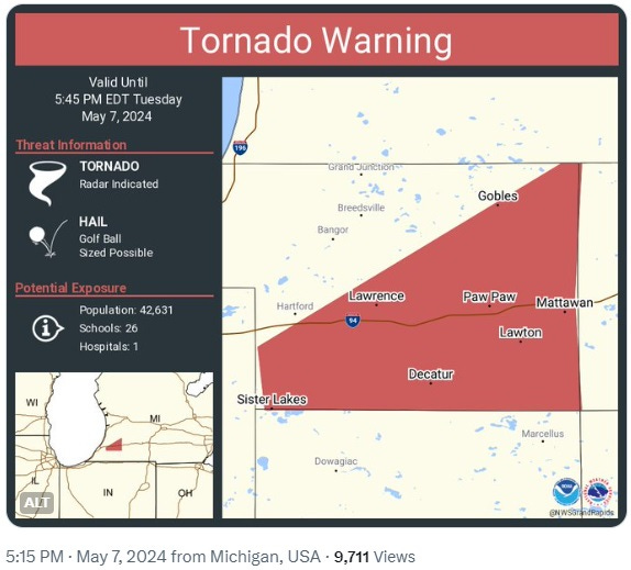
It’s interesting that the Northern Indiana NWS office (responsible for the southern row of counties in SW Michigan) issued this warning for northern Cass County 15 minutes before the Grand Rapids office issued the corresponding warning for SE Van Buren County for the same supercell.
Here’s the corresponding Warning issued 15 minutes later by the more conservative Grand Rapids NWS office for SE Van Buren County threatened by the same supercell in Berrien County.
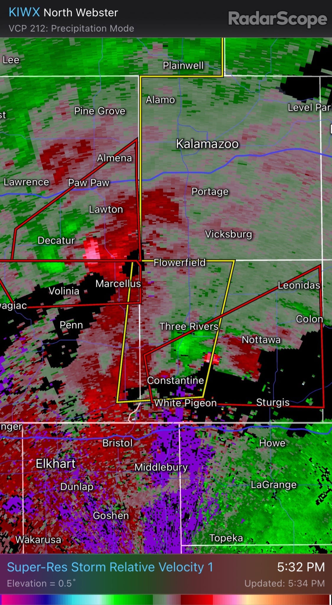
By 5:32 pm Doppler radar showed strong rotation aloft from the storm about to hit Portage and by this time a tornado warning was active for the tornado further south about to slice through Cass County (also outlined in red).
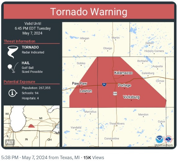
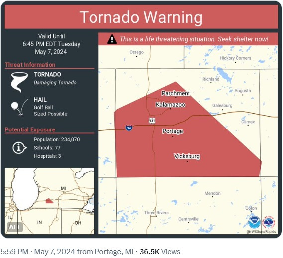
As the storm moved ENE, at 5:38 pm EDT this Tornado Warning was issued (based on radar signals) for much of Kalamazoo County including all of Portage and Kalamazoo too.
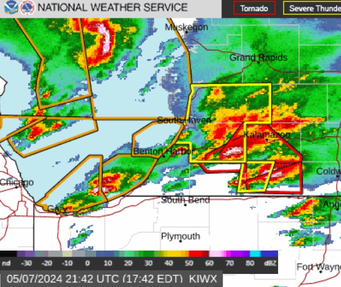
Radar at 5:42 EDT showed both supercells in SW Michigan with the tornado warning areas outlined in red.
Looking more and more like the storm was heading straight for Portage, I was monitoring the situation from my 2nd floor observation post at 5:48 pm while my wife and our dog wisely retreated to the basement.
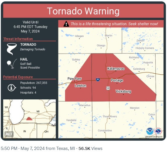
At 5:50 pm EDT the tornado warning was re-issued as a “life-threatening situation” based now on a confirmed tornado rather than just radar-indicated. The population in this Warning area is 267,000 people.
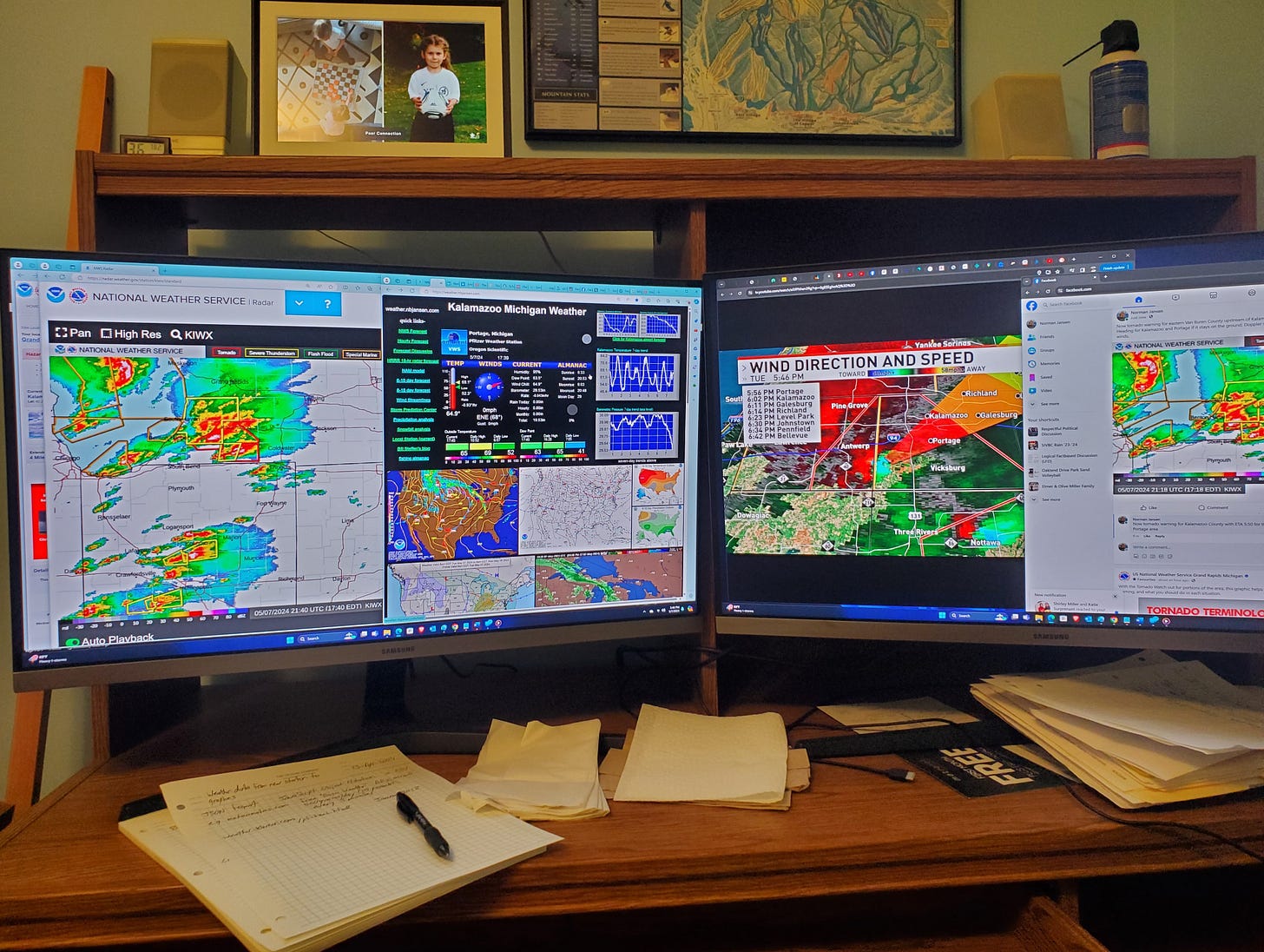
With an ETA around 5:58 pm for my longitude, I walked down to our main floor at 5:56 and took this screen shot of our Kalamazoo TV station WWMT which had been broadcasting live as were stations out of Grand Rapids and Battle Creek. A minute after this snapshot of their Doppler radar our power went out, although only for a minute or two. Our wind increased though only to perhaps 20 - 30 mph and only briefly. Unfortunately our large trees obscured my view to the south even when I went back upstairs to my perch. Fortunately we didn’t lose our trees like so many of our friends who live in the path of the twister did...
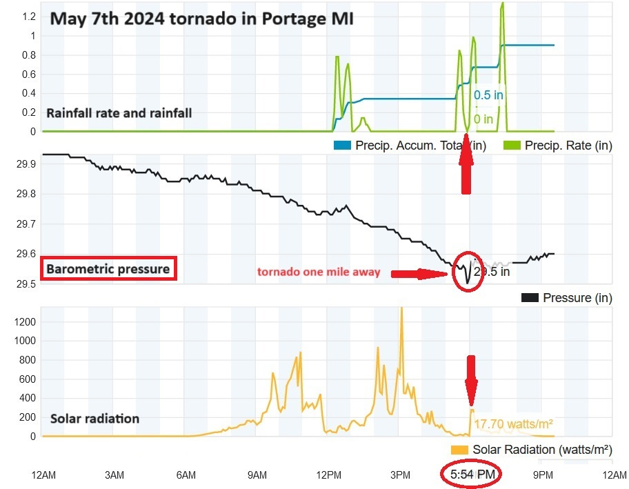
My weather station showed a slight pressure drop as the twister was passing south of us. We had brief though heavy rain right before and right after passage, yet the sun came out for several minutes while the tornado was at its nearest point to us (despite the graphic it was actually 1.6 miles to our south). With wind gusts estimated at only 25 mph one can imagine how a modest inflow of that velocity around the circumference of a three-mile circle would increase when focused at a vortex only several hundred yards wide.
At 5:59 pm EDT the tornado warning was ended for eastern Van Buren County, while still obviously in force for much of Kalamazoo County, yet had not been extended toward Galesburg just yet, At 6:06 it was extended all the way to the eastern edge of Kalamazoo County, and later into Calhoon county. Turns out the Portage tornado would lift before reaching Galesburg.
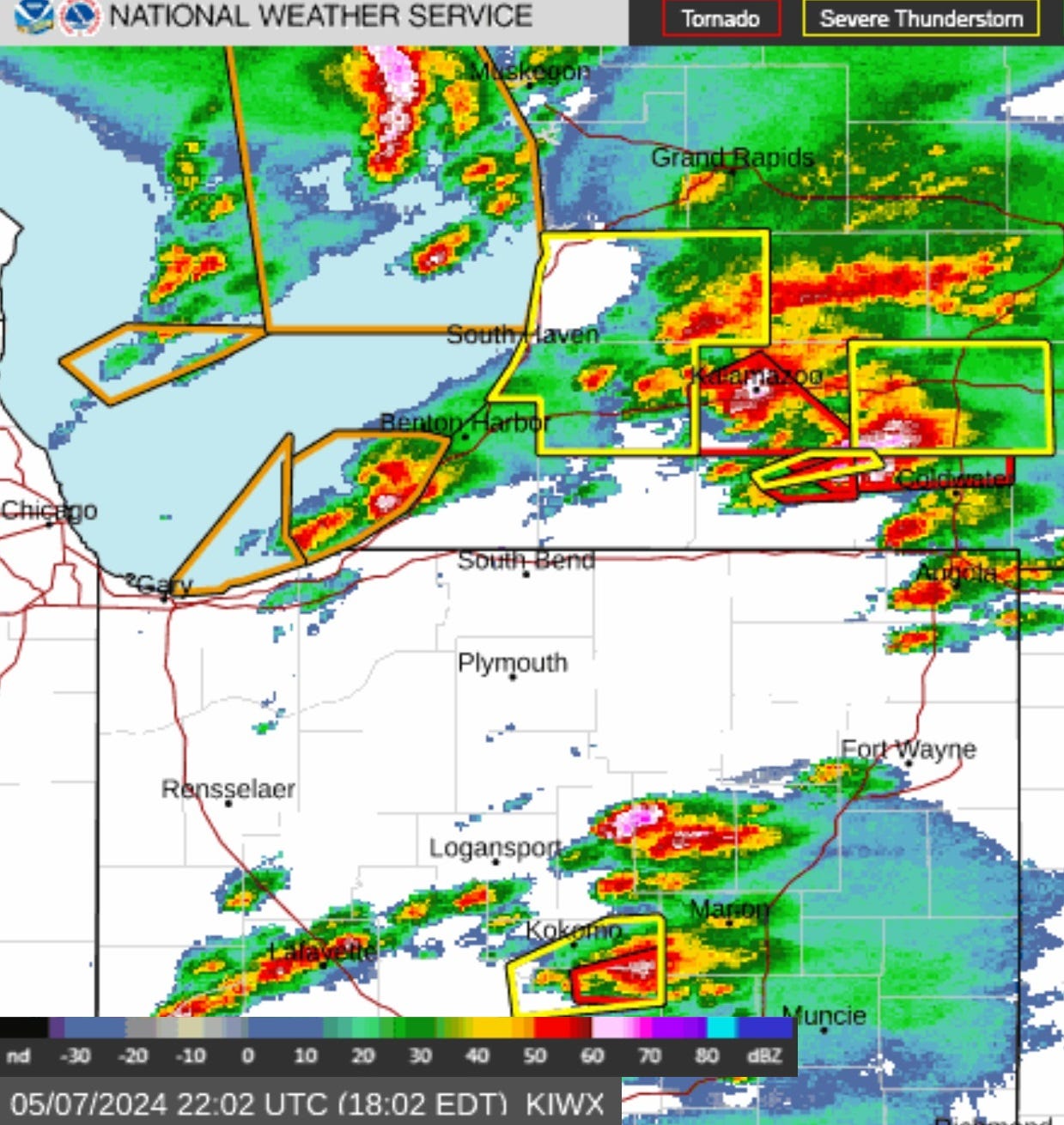
Radar at 6:02 pm EDT showed the storm at about the time the tornado had just finished destroying the Pizza Hut on Centre just east of Oakland. The radar map shows Interstate 94 through the middle of Kalamazoo County and most of Portage including the tornado track which was south of I-94. Note the follow-up storm coming onshore SW of Benton Harbor (also moving ENE). Also note another tornado warning southeast of Kokomo Indiana.
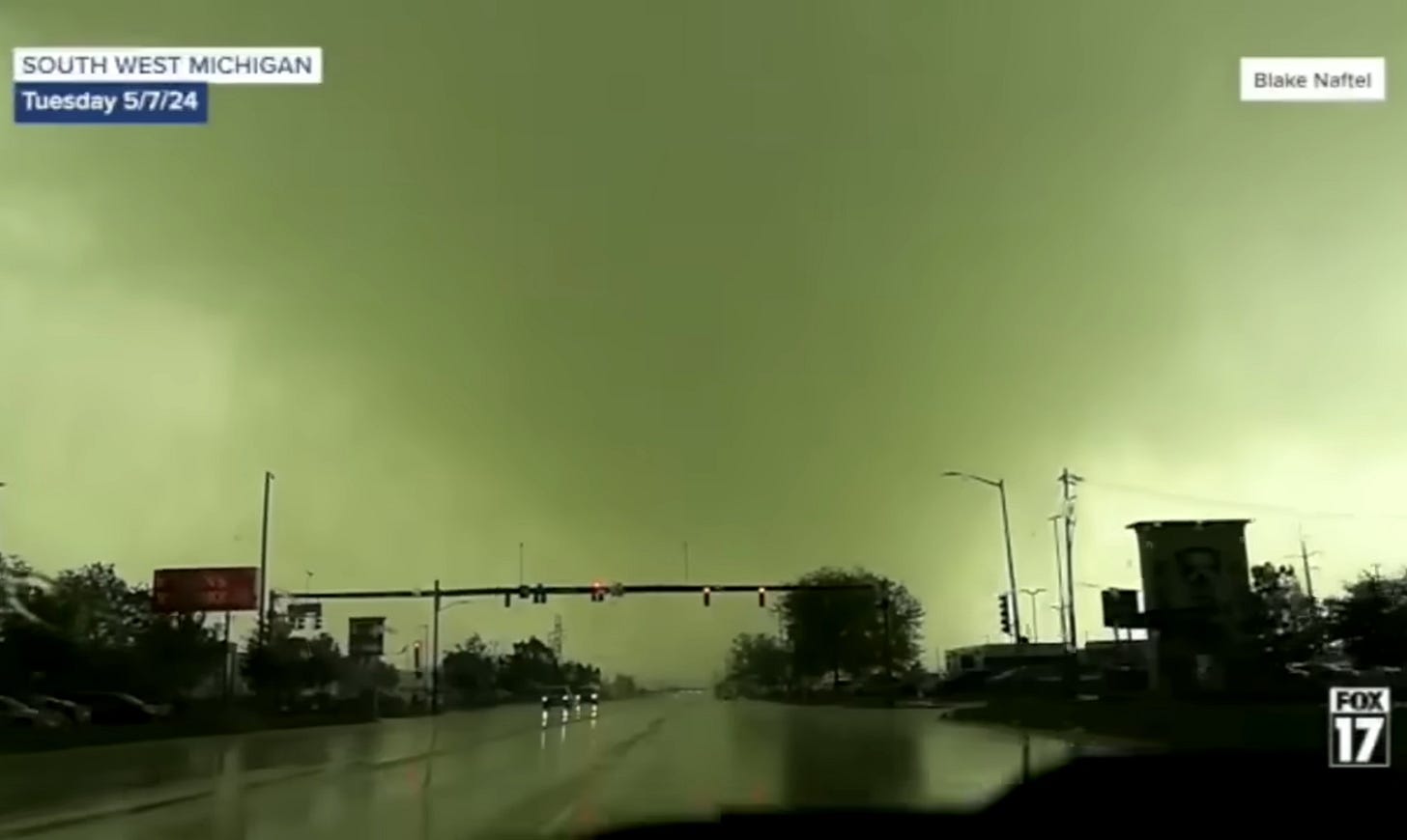
Storm Chaser Blake Naftel captured video of the Portage tornado from several vantage points. Here’s a screen shot of his video as he’s driving south on Westnedge Ave approaching Crossroads/Ruth at I’m guessing about 6:04 pm while the tornado is crossing Westnedge around Schuring Rd about a half mile south of Naftel’s vehicle. This link shows the video he licensed to WXMI-Fox17 and you can slide the time bar earlier to see more of his footage.
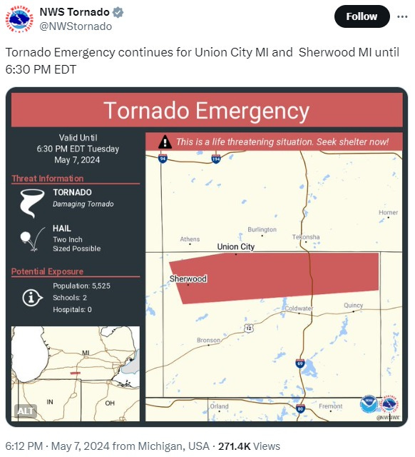
For the other tornado which was south of Kalamazoo County it’s interesting that a “Tornado Emergency” was declared at 6:12 pm EDT as it threatened up to 5525 people. It would be interesting to learn more about the criteria for “Tornado Emergency” vs “Particularly Dangerous Situation” and the more plain-vanilla “Tornado Warning” as both tornadoes had strong wind fields (subsequently rated EF-2) and the Portage tornado threatened an area with a population of over 200,000 people, 90 schools, and four hospitals. Perhaps it comes down to different philosophies between the Grand Rapids and Northern Indiana NWS offices or at least the meteorologists on duty that shift.
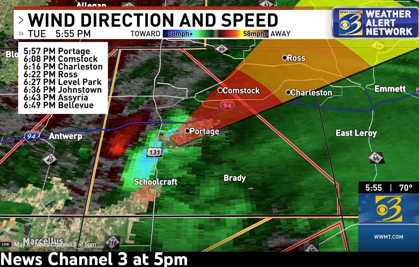
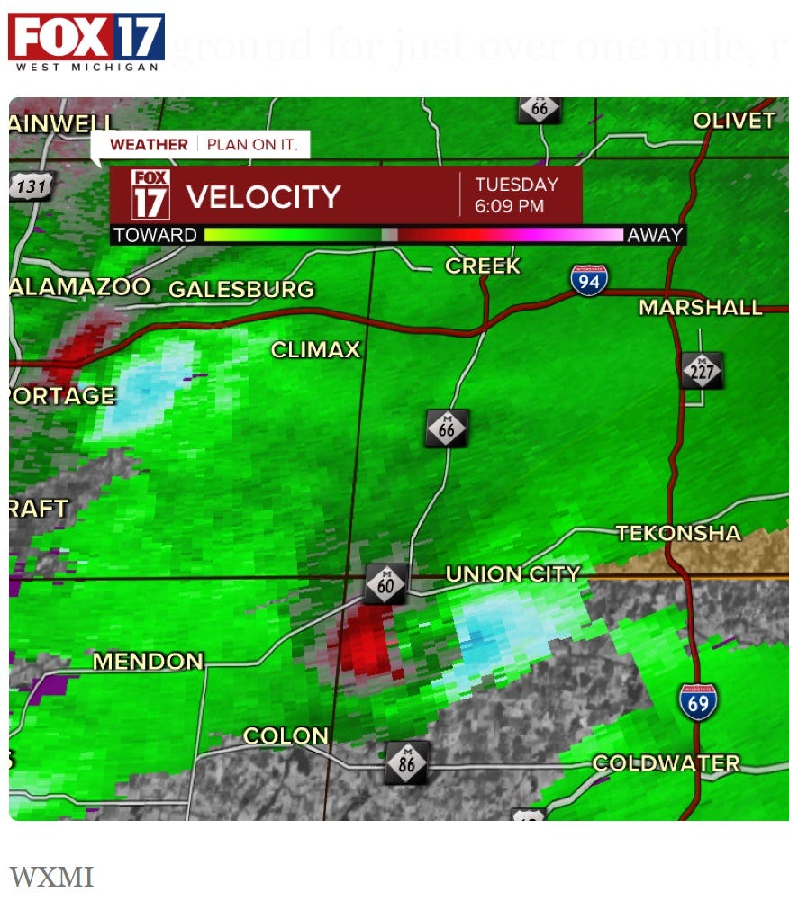
note added July 3rd- A Tornado Emergency is the highest alert level reserved for cases where the threat to human life and property is more extreme because a tornado with higher wind speed has been confirmed on the ground presenting an even greater threat since it's heading for an area of greater population density and/or its path width is greater. 20/20 vision is better than real-time judgement and the subsequent NWS reports show what I'll call the Centreville tornado (because we have friends in Centreville) touched down at 5:41 pm with a maximum path width of up to 950 yards and wind gusts up to 130 mph making it EF-2 like the Portage tornado. The Centreville tornado was on the ground for 30 minutes as it covered 19.6 miles moving ~30% faster than the Portage tornado which had a maximum path width 300 yards though winds up to 135 mph and on the ground for 22 minutes threatening a much larger number of people. The image below was captured by WXMI Fox17 showing wind velocity and direction aloft of both tornadoes at 6:09 pm (red and magenta with the tornado center in between).
The Tornado Emergency Tweet shown above was issued at 6:12 pm which turned out to be a minute after the Centreville tornado lifted. Subsequent NWS analysis reported a short-lived tornado that touched down near Union City at 6:07 just before the Centreville tornado (which video showed was multi-vortex) lifted. The Union City tornado from the same supercell was rated EF-1 with a path width of 100 yards and on the ground for only 1.1 miles with winds up to 95 mph. Here's an NWS explanation of the difference between and Emergency, Warning, and Watch. For warnings NWS also sometimes distinguishes a "Particularly Dangerous Situation" and whether the tornado is only radar indicated or confirmed on the ground perhaps with a debris field well-defined. Here’s a link to an interview with a member of the Northern Indiana NWS meteorology team that covers the southern row of counties in SW Michigan and issued Warnings and the Emergency that day. A “better safe than sorry” philosophy resulted in no lives lost on May 7th, although over-using words designed to apply to more serious danger also results in apathy instead of taking warnings seriously. I give credit to the NWS for issuing Tornado Warnings for specific trapezoids instead of entire counties in order to avoid “the boy who cried wolf” syndrome. And for using different words for different levels of danger as best as human judgement can estimate.
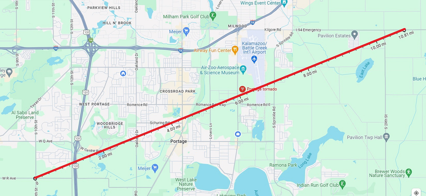
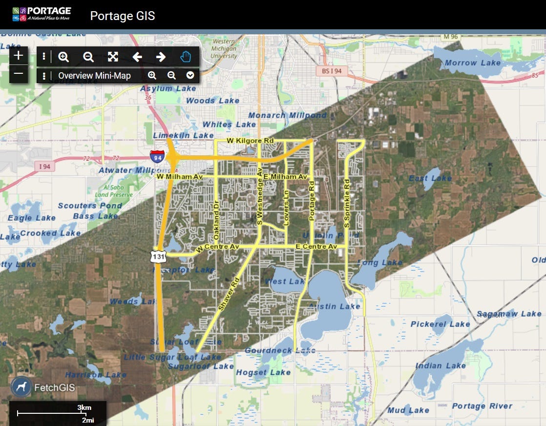
The map below shows the path the Portage tornado took assuming a straight line between touchdown at 5:55 pm EDT and liftoff at 6:17, ignoring some wobble that occurs for most tornadoes (and variable damage suggesting that mini-vortices often spin in the “outer wall” of the main twister even though not always as easy to visualize as they were for the tornado further south).
Path and damage images
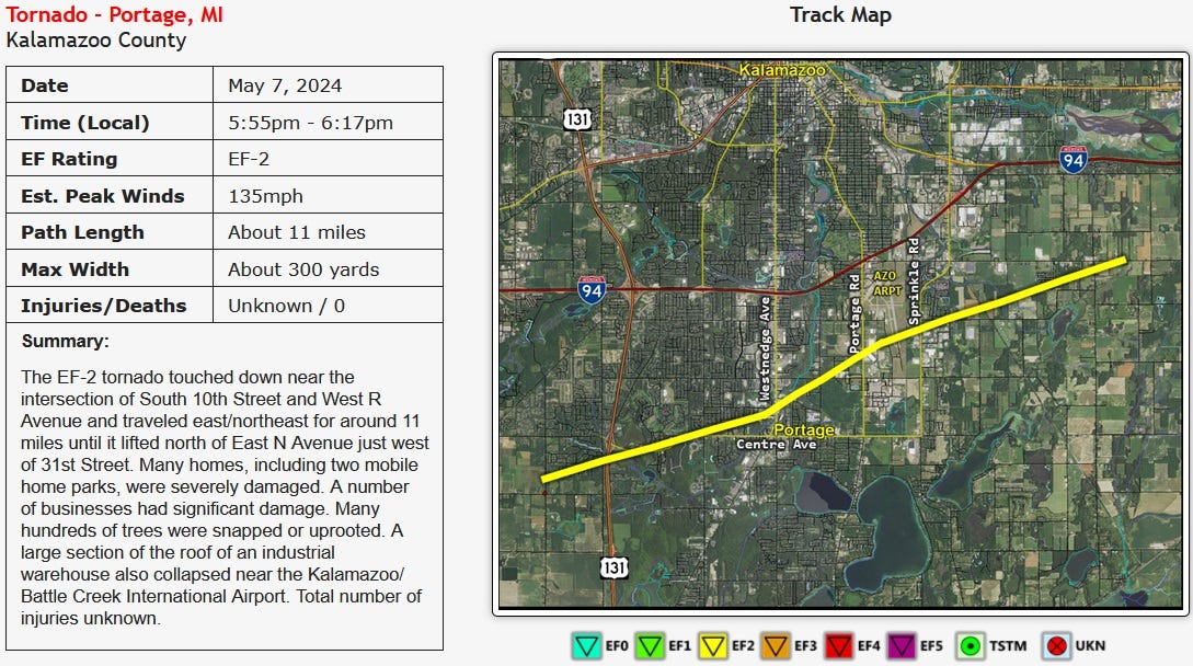
The official NWS survey report showed touchdown near the intersection of South 10th Street and West R Avenue in Texas Township one mile west of the edge of Portage. The twister was on the ground for 11 miles with an average forward movement of 30 mph and wind gusts up to 135 mph (making it EF-2) with a maximum width of 300 yards (a fifth of a mile). Thanks to early warning (and people heeding the sirens) and information from local media, there were no deaths and apparently only a few serious injuries. A more complete summary of the tornado is provided by the Grand Rapids NWS office at https://www.weather.gov/grr/7_May_2024_SevereWeather
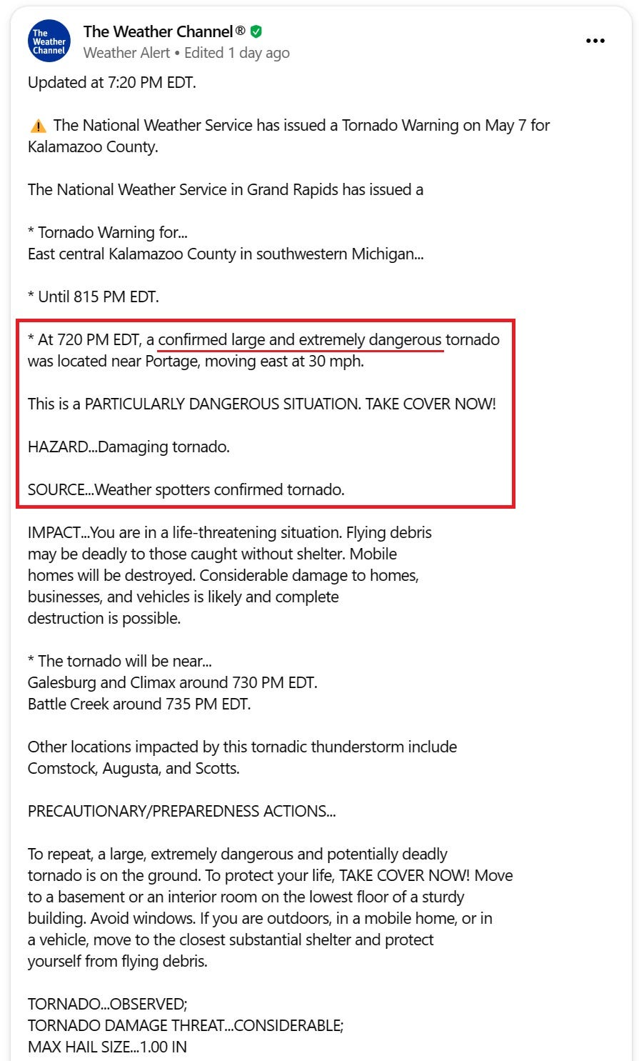
In a strange case perhaps of oversensitivity, as a second thunderstorm followed a similar track over Portage a little over an hour later, and Doppler radar showed rotation aloft though not as strong as for the real tornado, the NWS updated this new tornado warning at 7:20 pm EDT for the follow-up storm that at this time was already over Portage (as my wife and I were eating at Moe’s Soutwest Grill on Westnedge north of Romence at 7:20). This warning was for a “confirmed large and extremely dangerous tornado” and was declared a “Particularly Dangerous Situation” although subsequent analysis didn’t confirm a touchdown of what appears to have just been a funnel cloud. That “chaser” storm did deliver another short burst of heavy rain on my rain gauge.
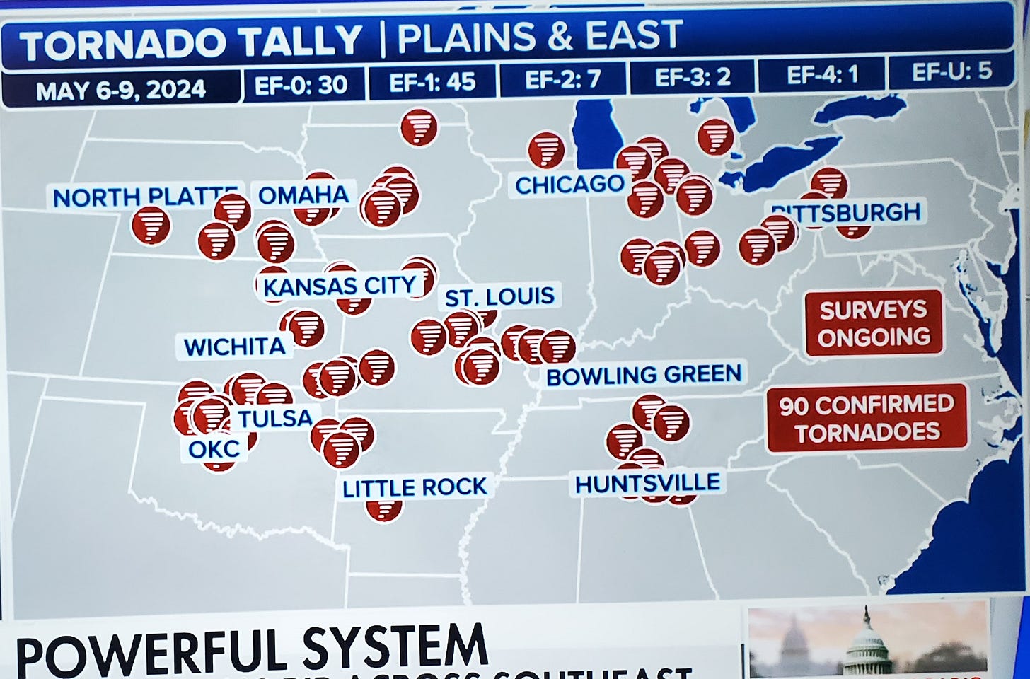
The two confirmed EF-2 tornadoes in Kalamazoo and Cass counties were part of a larger outbreak over four days that included 10 tornadoes rated EF-2 or higher and 75 rated EF-0 and EF-1.
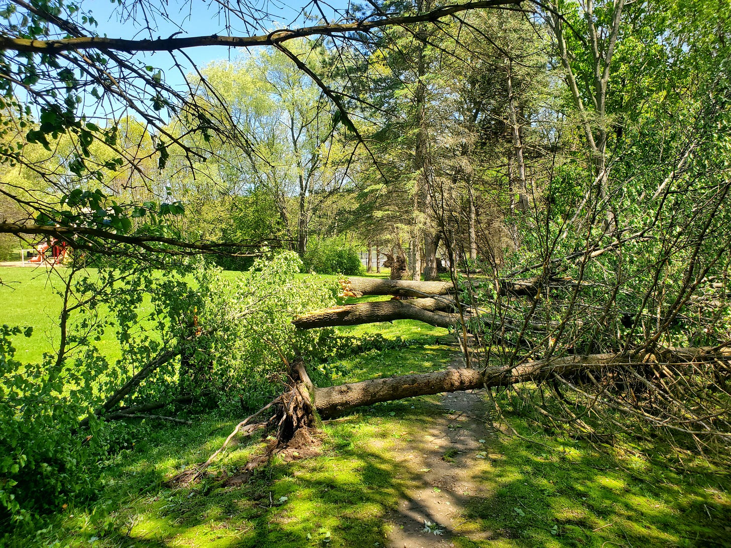
The day after the tornado I fought traffic from other gawkers and walked part of the tornado’s path along Centre Avenue. Due to gridlock (key roads were still closed) I parked at Oakland Drive Park and walked south from there. Some trees were down at the southern edge of Oakland Drive Park about a third of a mile north of the tornado’s path.
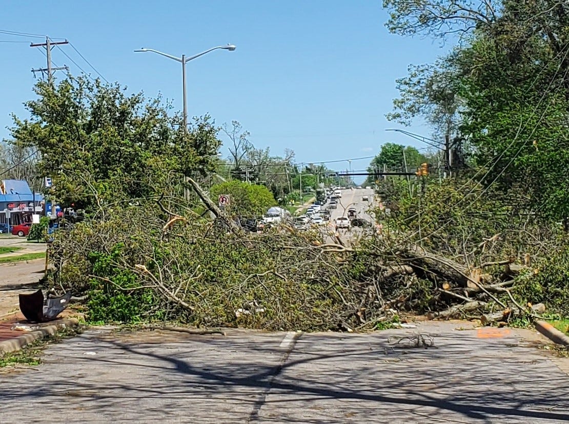
Centre Avenue was still closed as crews worked to clear the downed trees and repair utility lines. This view is looking east toward the Oakland Drive intersection.
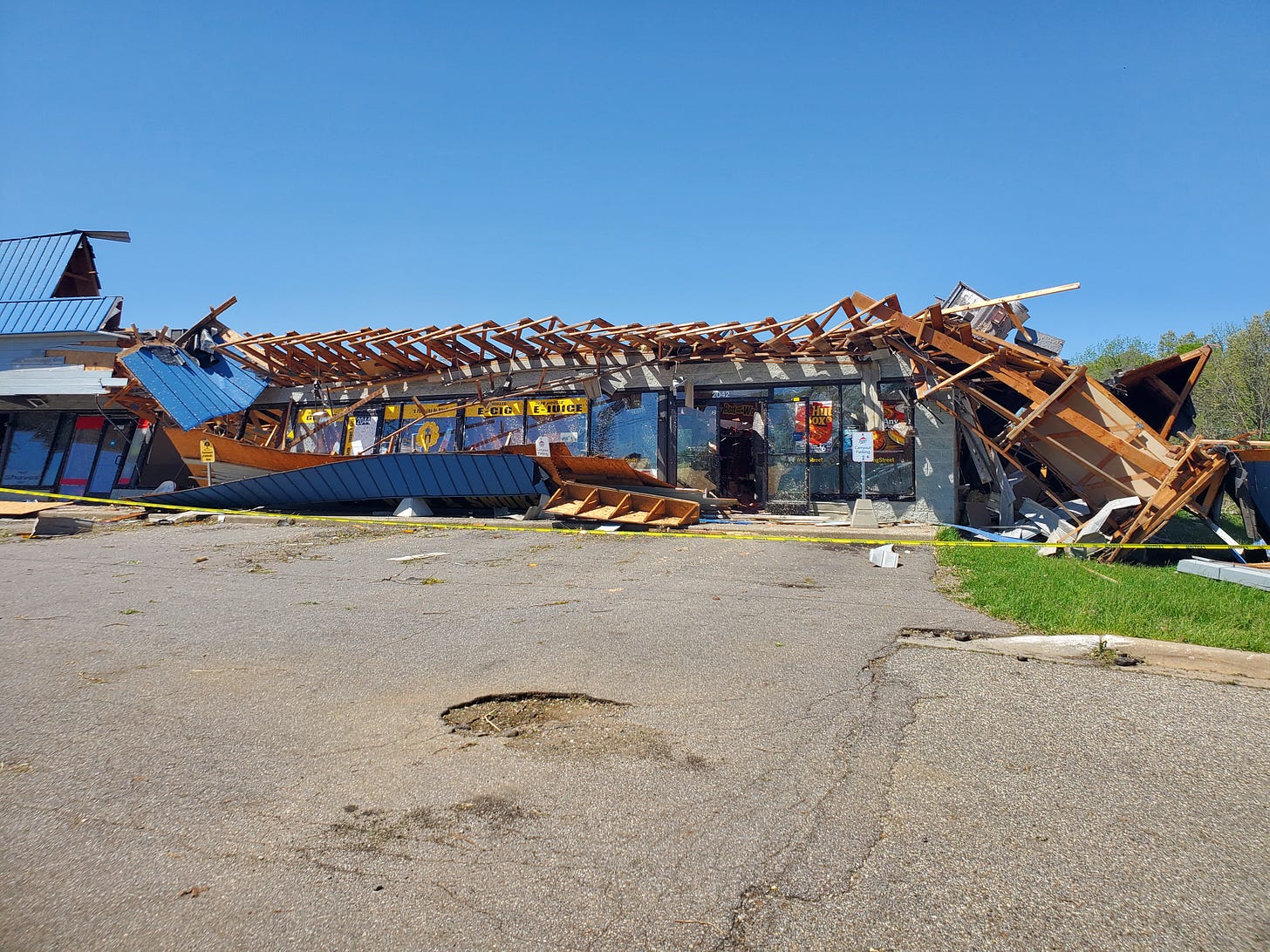
The Pizza Hut at the east end of the strip mall just east of Oakland Drive was hit hard, and the back side of that entire building looked even worse. One of my soccer friend’s daughter’s neighbor took cover in the Pizza Hut walk-in cooler while this happened.
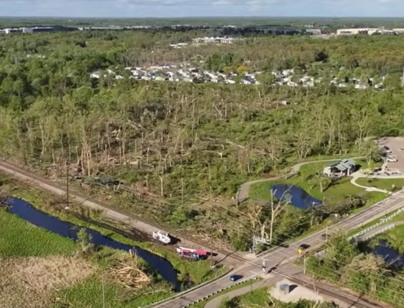
Staufer Aerial shared video of their drone flight over entire path of the twister and this link shows its approach to Colony Woods in Texas Township just west of Portage. Here’s a screen shot from their video looking NE showing the trees taken down at Celery Flats.
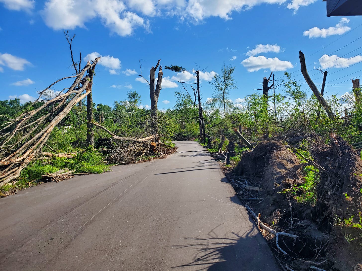
Two weeks after the tornado they’d cleared the Celery Flats trail that used to pass through scenic woods from Garden Lane up to Romence. Much different than it was.
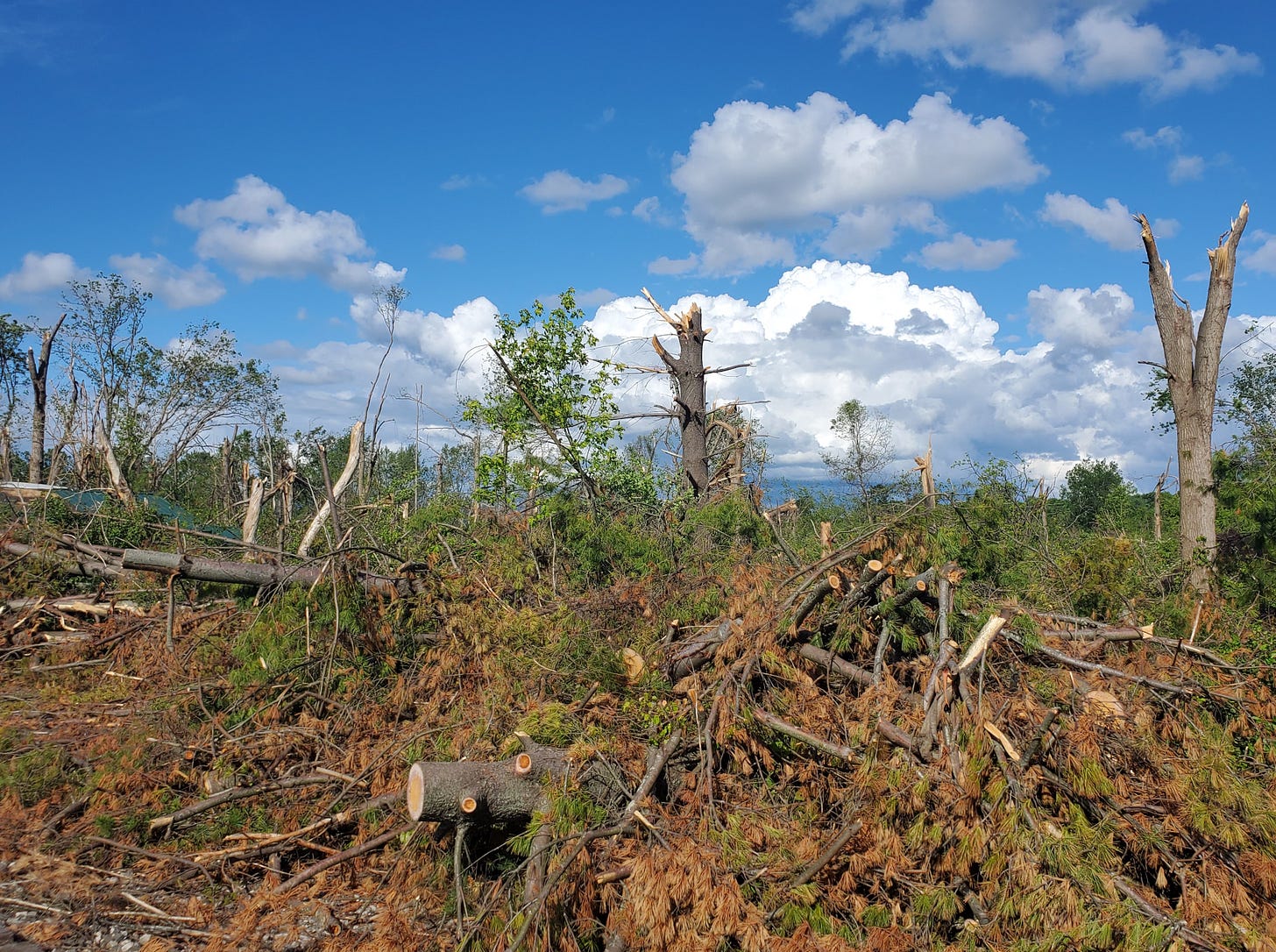
Looking east through what used to be a heavily wooded area, the habitat will now be changing with bright sunshine instead of cool shade.
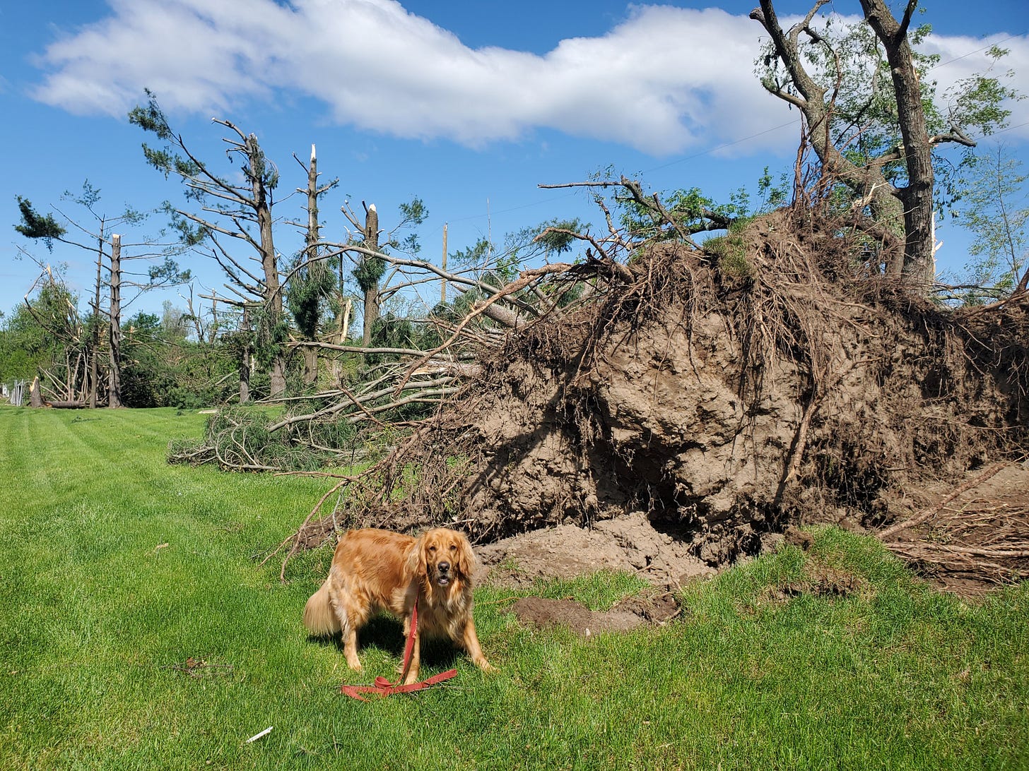
On the Friday after the tornado my dog and I took a walk along Romence Road from Lovers Lane to Portage Road and Mackey was wondering what happened to the woods.
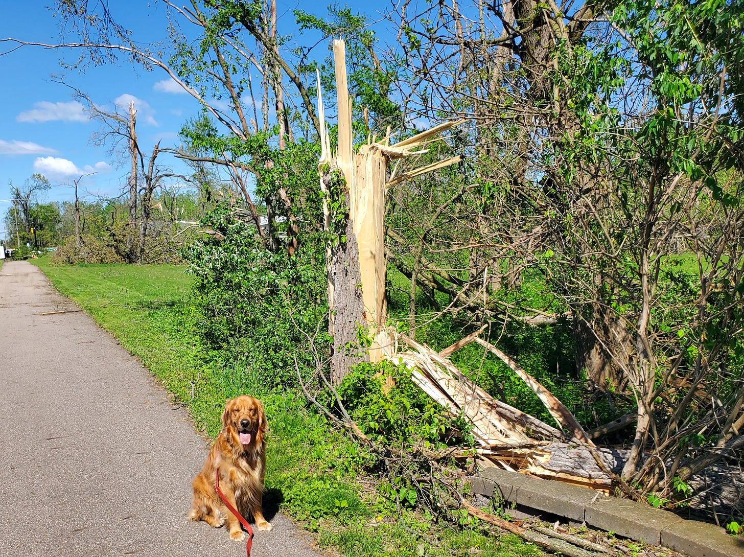
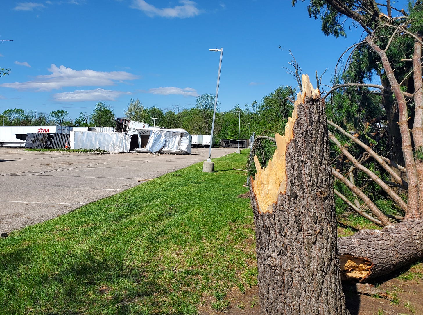
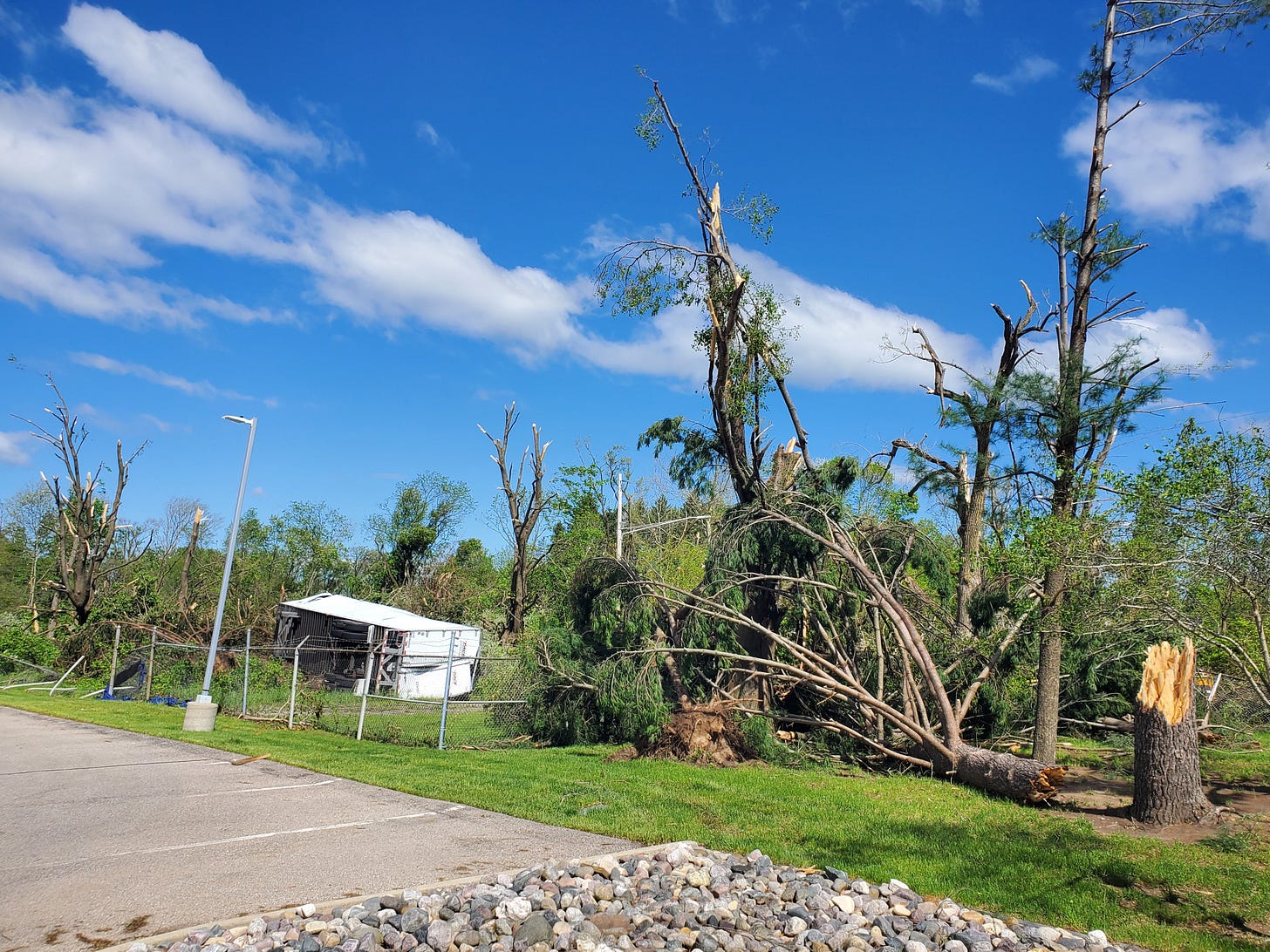
Some trees were blown over while others were decapitated along Romence (and the entire path of the tornado for that matter).
Many semi-trailers were parked just west of the Stryker Office building that used to be the Upjohn “Quads” on the south side of Romence and some of them didn’t fare much better than the trees.
One of the trailers was tossed over the fence toward Kromdyke Ave.
This EF-2 tornado moved some of the semi-trailers like they were toys.
Further northeast the tornado sliced through the middle of the FedEx Ground facility on Portage Road just south of the airport. A similar view was shared by many national news outlets.
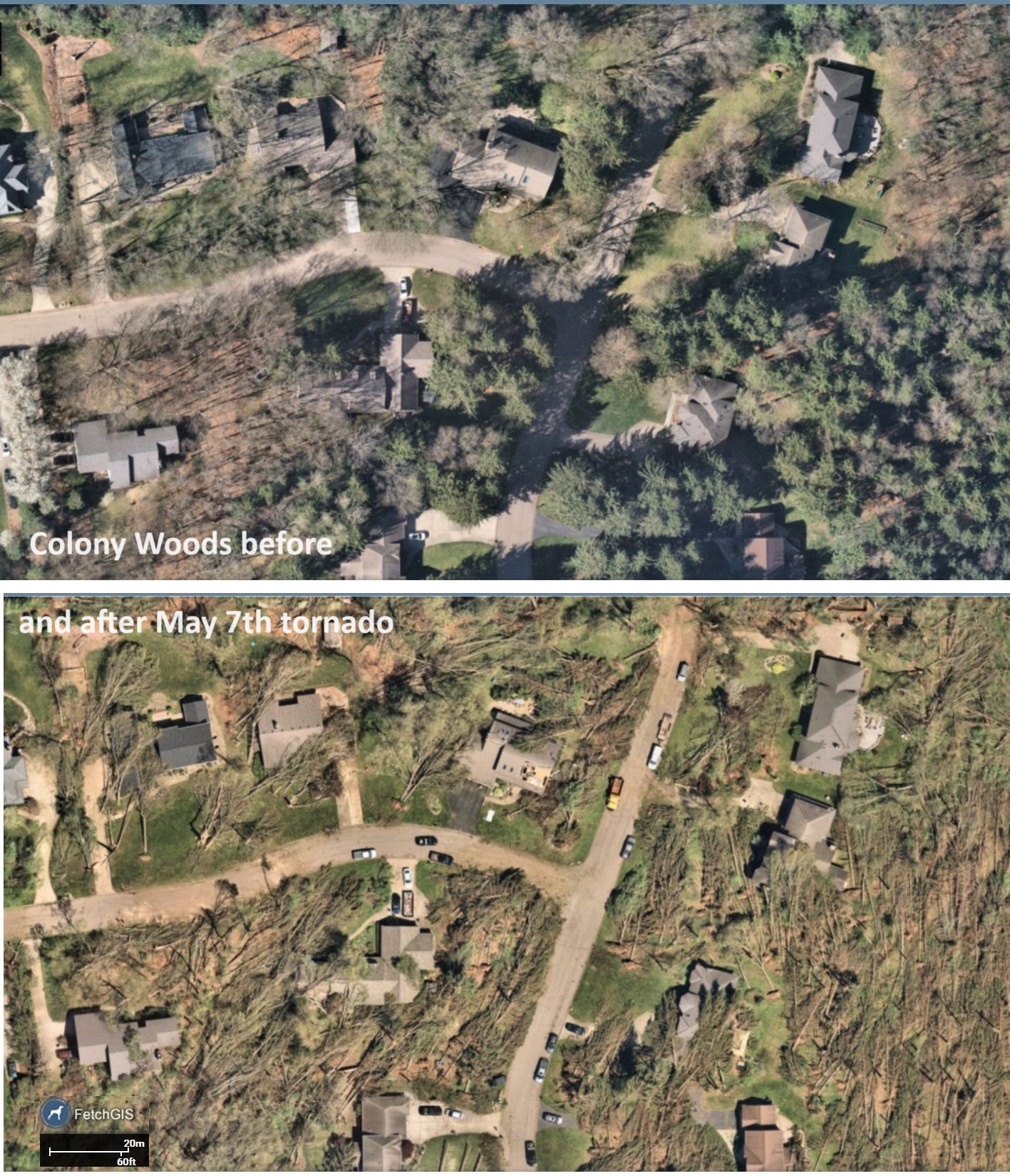
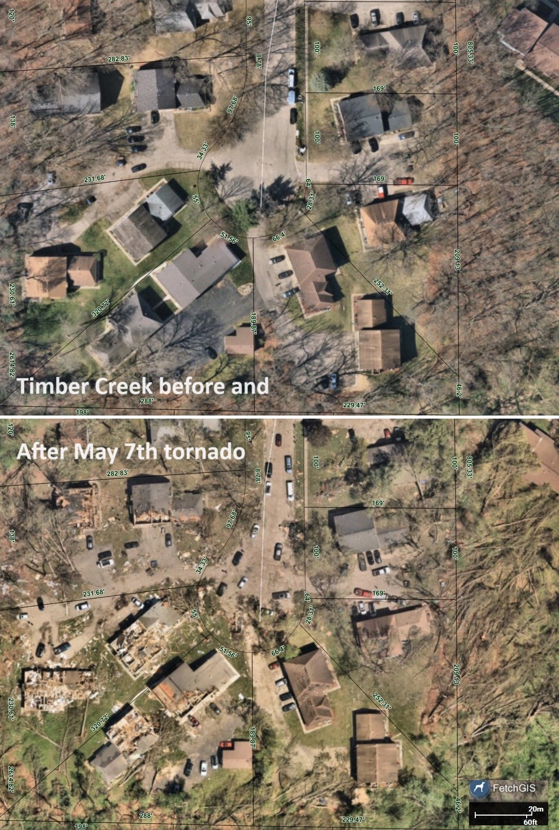
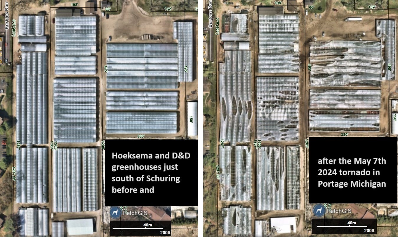
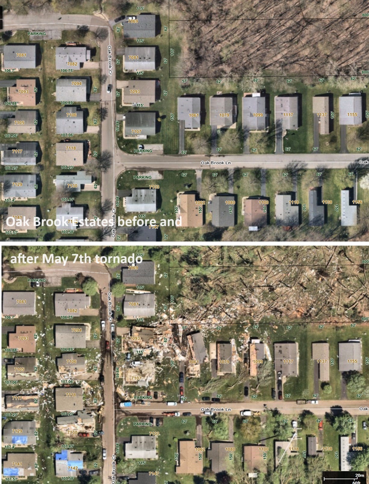
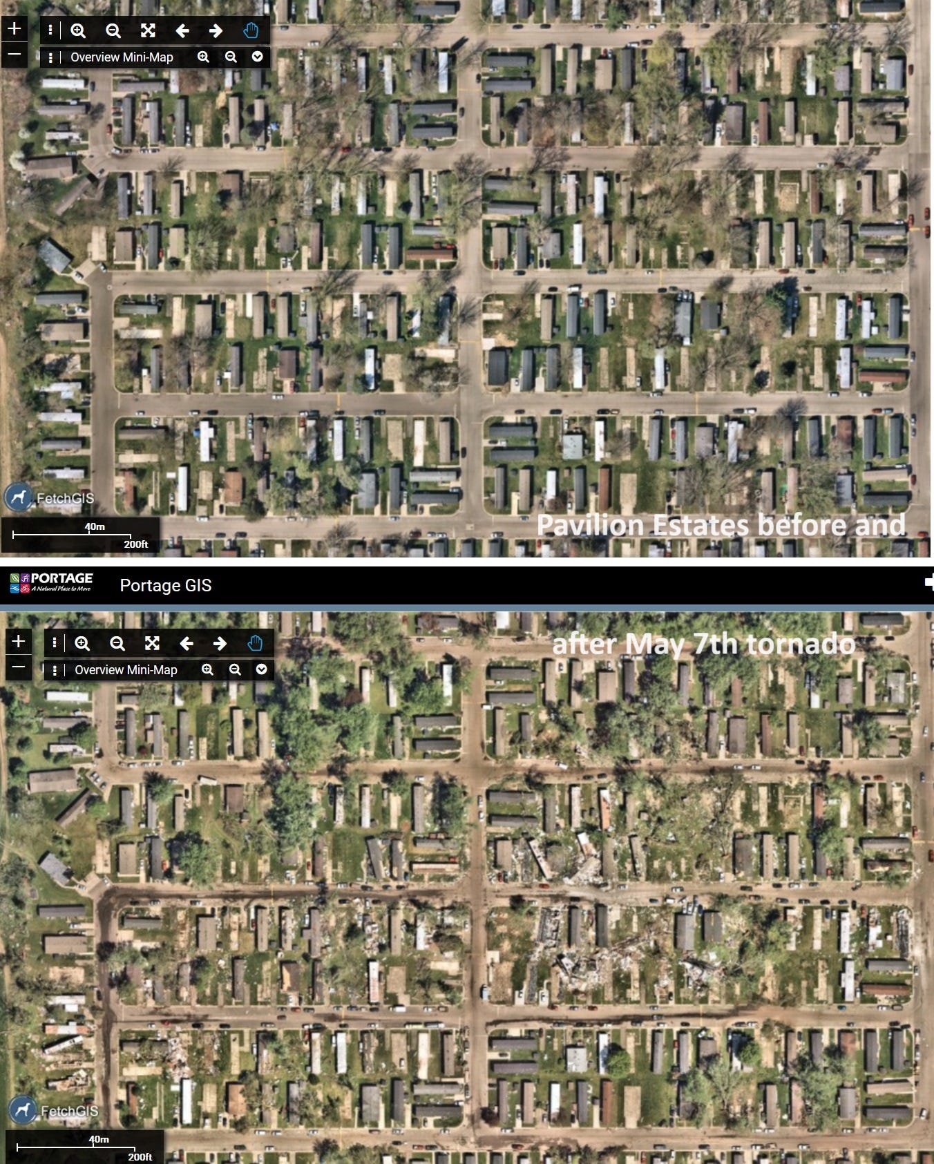
The city of Portage updated their GIS Mapping service with high resolution images over the path of the tornado as shown below, which was helpful for insurance claims.
Before and after aerial views of the eastern part of Colony Woods in Texas Township.
Townhomes on Timber Creek just south of Schuring before and after.
The Hoeksema and D&D greenhouses just south of Schuring didn’t fare well.
As it passed through Oak Brook Estates some homes were destroyed while others survived.
Same for Pavillion Estates further northeast shortly before the tornado lifted.
Conclusion
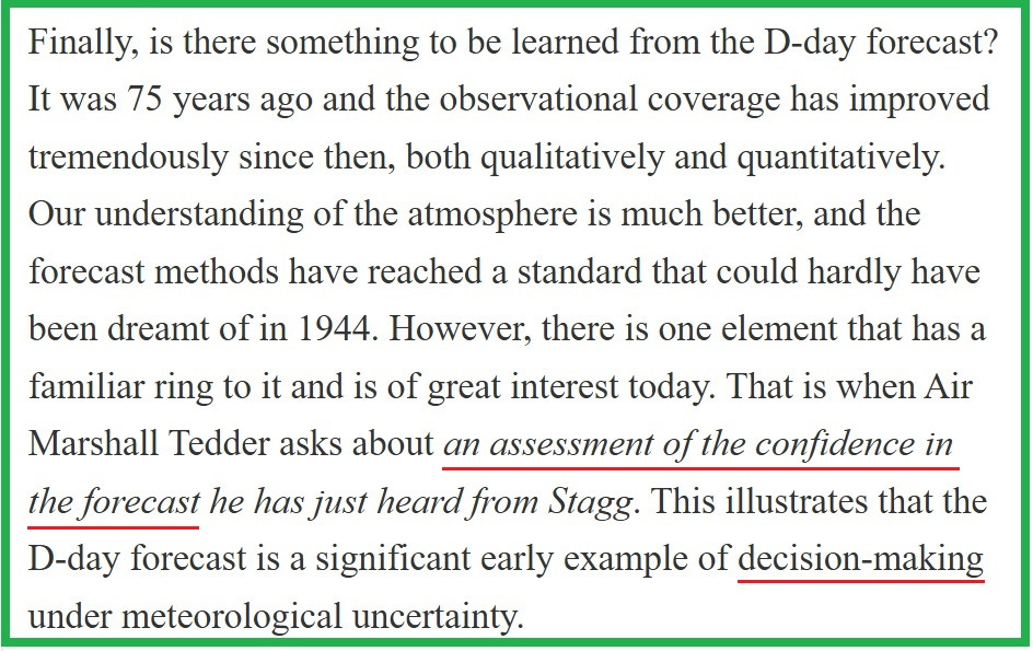
As I finish writing this on the eve of the 80th anniversary of D-Day when so many lives depended on accurate weather forecasting it’s interesting to read analyses like this by Swedish meteorologist Anders Persson regarding the challenges of forecasting weather for the English Channel before that invasion. We can be thankful our information and forecasting capabilities are far better today than then (when conditions notably the wind were less favorable than forecast and sadly exacerbated casualties). Yet forecasts today are still not perfect. Like leading up to D-Day, differences between forecast offices and forecasters (including tolerance for risk) result in differences in how soon warnings are issued, and what threats are judged a “Particularly Dangerous Situation” or a “Tornado Emergency” compared to a standard Tornado Warning in the current situation. The philosophy of “better safe than sorry” is good until it leads to complacency due to “the boy who cries wolf” effect that conditions people to ignore serious warnings that should be heeded. These are at odds with each other and perhaps always will be. Regarding meteorological uncertainty, here’s Anders Persson’s wrap-up comment five years ago that applies both 80 years ago and today-
note- this Blogger post was taken from this Substack article.
Comments
Post a Comment